3 Rounds of Snow Possible, First Event Tuesday Afternoon
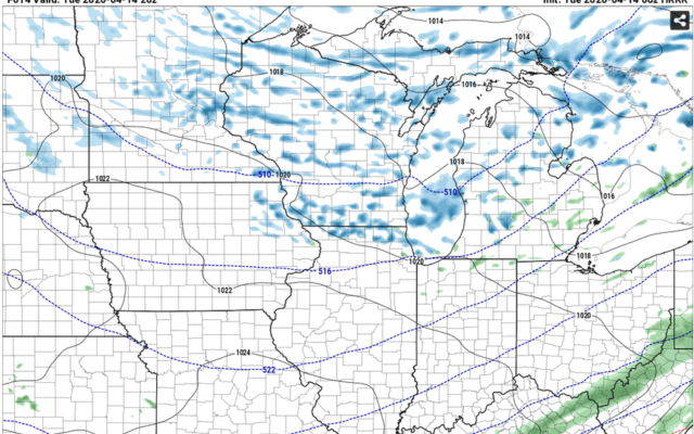
Snowshowers will once again develop this afternoon as a potent short wave moves quickly across Southern Wisconsin and Northern Illinois. This event will be similar to last week when we had afternoon snowshowers develop by noon and lingered until 6 p.m. This event appears to be shorter, (4 hours) in duration but more intense in magnitude due to the atmosphere being nearly 5 degrees COLDER than last week. There is a chance that some areas could pick up a quick dusting to 1/2″ under the heavier snowshowers. Temperatures at 18,000 feet or -38F!!!! which means all precipitation will fall as a mixture of wet snowflakes and/or graupel.
The second light snow event will occur between 3 a.m. and 8 a.m. when a weak wave moves through with very light snowshowers mainly south of I-80. This would lay down a quick 1/2″ in some areas but will melt when the sun rises after 630 a.m.
The third precipitation event will occur Thursday night into Friday morning as a strung out wave of low pressure moves across central Illinois. This next system will last about 8 – 10 hours producing a large west to east band of mixed rain and wet snow. As we have seen in the past, if precipitation falls hard enough at night, there could easily be a solid 2 to 4″ accumulation of wet snow. Surface temps will be warm enough to keep snow from accumulating more than 1″ on streets, but do not be surprised to see a few inches on sidewalks and some parking lots from Peoria to Kankakee.