NWS: Severe Weather This Afternoon With A Tornado or Two Possible
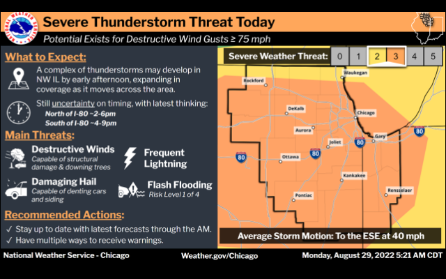
Severe thunderstorms are possible this afternoon and evening areawide (Risk Level 3 of 5). The threat for destructive wind gusts of 75 mph is highest along and north of I-80. Additional hazards include damaging hail, frequent lightning and localized flash flooding. A brief tornado or two also cannot be ruled out.
While there is a small chance for a few thunderstorms early this morning, more robust thunderstorms are expected to develop with a cold front approaching far northern IL in the 1 to 3 pm timeframe. Once storms initiate, rapid intensification could support some isolated instances of hail. However, strong potentially destructive winds are expected to quickly become the primary severe threat through the late afternoon and early evening hours. A tornado or two is also possible.
Very heavy rainfall is also expected to accompany these storms, and this could result in areas of flooding, especially in any locales that experience prolonged periods of storms.
National Weather Service