Thursday: A Major Winter Storm
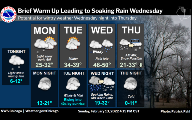
While it is still 4 days away, there is an increasing chance for a MAJOR WINTER STORM to impact the Chicago area. The GFS or Global Forecast System has been inconsistent with the track of the storm and potential snowfield. While the model shows high snowfall totals, it has jogged back and forth several times.
The European Model has been more consistent and FURTHER SOUTH keeping us in a lighter snowfall regime. Nonetheless, it does appear we will get into the 40s to near 50 on Wednesday with rain before a changeover to sleet, freezing rain and all snow on Thursday!
If the GFS verifies, we could get 1 to 1.5″ inches of rain before a healthy 6 to 10″ snow!
If the EURO verifies, we could get .50 to .75″ rain and only 3 to 4″ snow.
WJOL Staff Meteorologist Rick DiMaio