Powerful Cold Front Will Drop Temperatures Severely With Risk Of Tornadoes And Snow Overnight
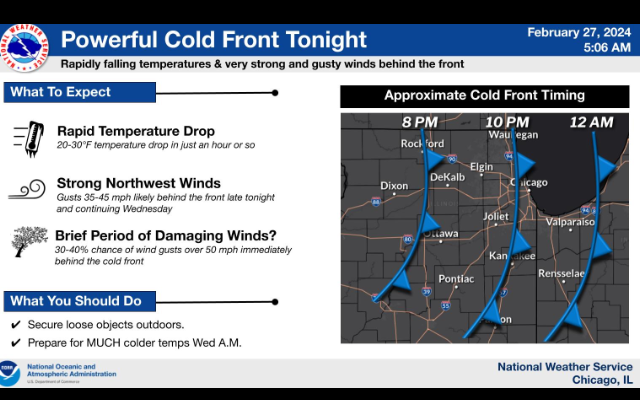
A powerful cold front will race quickly across the area this evening producing a 20-30°F temperature drop in just an hour or so and strong northwest winds gusting to 35-45 mph. A brief period of gusts over 50 mph are possible (30-40%) immediately behind the front.
Scattered t-storms are expected this evening (6PM until Midnight) with some of the storms potentially becoming severe. The primary threat is large hail, possibly up to 2” inches diameter. There is also a threat of locally damaging winds and a tornado or two.
The temperature change between this evening and sunrise Wednesday will be nothing short of dramatic! After summer-like temps in the 70s today, tomorrow morning’s wind chills near or below zero will feel absolutely brutal.
A period of snow is possible late tonight and could produce some accumulations. There is still a lot of uncertainty regarding how much, if any snow will occur tonight. If snow does fall, the rapidly falling temps will likely lead to roads becoming snow covered and hazardous.
National Weather Service