Storms Target Illinois Along With Big Temperature Swings
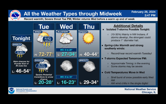
It could be a very stormy day in Central Illinois today. Forecasters say there is a significant chance of severe storms in the region due to a cold front pushing into the unseasonably warm weather the region has been having the past couple of days. While temperatures are expected to go as high as the upper 70s today, scattered thunderstorms are expected along with hail and the potential for tornadoes. Some of that wet weather is expected to last into Wednesday.
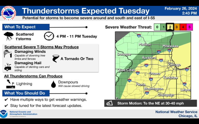
There is a potential for storms to become severe around and south and east of I-55. The National Weather Service reports, there is a level 2 of 5 risk of severe storms late Tues PM into Tues evening. Uncertainty in the precise location of the main severe risk remains uncertain, but any storms that develop could produce large hail, damaging winds, and even a tornado or two.
Meanwhile, record warmth with back to back day of temperatures in the 70’s but then a big drop tomorrow with temperatures around the freezing mark.